 vesseltracker.com
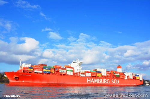
 Cap San Raphael
Current Status
Where is the vessel?
Cap San Raphael is currently in Near Wangerooge, based on AIS data received less than 1h ago.
Latest AIS update:
Current position: 53.88194° N, 7.79521° E (Near Wangerooge)
Average speed (last 7 days): Loading…
Average speed (last 30 days): Loading…
Vessel profile: Cap San Raphael is a Container Ship with dimensions 333m x 48m.
This page combines live AIS, route history, probable destination signals, nearby traffic, and port activity for practical vessel monitoring.
The current position of vessel Cap San Raphael is 53.88194 lat / 7.79521 lng. Updated: 2026-05-15 15:33:05 UTCNearest reference points:
- Near Wangerooge
- Near Helgoland
- Near Horumersiel
Currently sailing under the flag of Denmark ![]()
Cap San Raphael built in 2014 year
Deadweight:
124460 tDetails:
Live Vessel Cap San Raphael Analytics (details, animations, etc.)
Recent AIS points (UTC):
2026-05-15 11:41:09 UTC · 53.59958, 8.51343 · SOG 0 kn · COG 141°2026-05-15 13:08:04 UTC · 53.59942, 8.51275 · SOG 0.8 kn · COG 143°
2026-05-15 13:29:40 UTC · 53.59819, 8.50904 · SOG 6.9 kn · COG 320°
2026-05-15 15:33:05 UTC · 53.88194, 7.79521 · SOG 15.9 kn · COG 284°