 vesseltracker.com
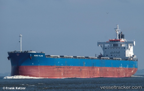
 NORD KUDU
Current Status
Where is the vessel?
NORD KUDU is currently in 134 nm NW of Tijarafe, based on AIS data received about 1h ago.
Latest AIS update:
Current position: 29.70620° N, 20.22675° W (134 nm NW of Tijarafe)
Average speed (last 7 days): Loading…
Average speed (last 30 days): Loading…
Vessel profile: NORD KUDU is a Cargo with dimensions m x m.
This page combines live AIS, route history, probable destination signals, nearby traffic, and port activity for practical vessel monitoring.
The current position of vessel NORD KUDU is 29.70620 lat / -20.22675 lng. Updated: 2026-05-13 18:11:06 UTCNearest reference points:
- 100 nm W of Tijarafe
- 119 nm W of Frontera
- 137 nm SW of Ponta do Pargo
Currently sailing under the flag of Marshall Islands ![]()
Details:
Live Vessel NORD KUDU Analytics (details, animations, etc.)
Recent AIS points (UTC):
2026-05-13 14:10:26 UTC · 29.06867, -20.63060 · SOG 11.4 kn · COG 35°2026-05-13 16:15:08 UTC · 29.37667, -20.38167 · SOG 10 kn · COG -1°
2026-05-13 17:06:07 UTC · 29.52167, -20.31333 · SOG 11 kn · COG -1°
2026-05-13 18:11:06 UTC · 29.70620, -20.22675 · SOG 10.7 kn · COG 22°