 vesseltracker.com
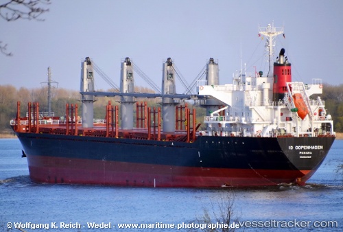
 Ever Gallant
Current Status
Where is the vessel?
Ever Gallant is currently in 210 nm NE of Guiuan, based on AIS data received about 2h ago.
Latest AIS update:
Current position: 12.44806° N, 128.97815° E (210 nm NE of Guiuan)
Average speed (last 7 days): Loading…
Average speed (last 30 days): Loading…
Vessel profile: Ever Gallant is a Bulk Carrier with dimensions 170m x 27m.
This page combines live AIS, route history, probable destination signals, nearby traffic, and port activity for practical vessel monitoring.
The current position of vessel Ever Gallant is 12.44806 lat / 128.97815 lng. Updated: 2026-05-15 15:10:24 UTCNearest reference points:
- 281 nm E of Gigmoto, Catanduanes
- Open sea, approx. 402 nm off the nearest listed port
- Open sea, approx. 404 nm off the nearest listed port
Currently sailing under the flag of Panama ![]()
Ever Gallant built in 2012 year
Deadweight:
28206 tDetails:
Live Vessel Ever Gallant Analytics (details, animations, etc.)
Recent AIS points (UTC):
2026-05-15 13:06:13 UTC · 12.90477, 129.04958 · SOG 13.3 kn · COG 190°2026-05-15 13:06:13 UTC · 12.90477, 129.04958 · SOG 13.3 kn · COG 190°
2026-05-15 15:10:24 UTC · 12.44806, 128.97815 · SOG 13.5 kn · COG 188°
2026-05-15 15:10:24 UTC · 12.44806, 128.97815 · SOG 13.5 kn · COG 188°