 vesseltracker.com
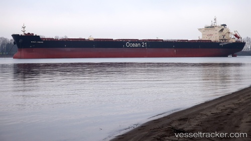
 Boga Indah
Current Status
Where is the vessel?
Boga Indah is currently in 328 nm E of Gigmoto, Catanduanes, based on AIS data received about 2h ago.
Latest AIS update:
Current position: 15.38833° N, 129.77834° E (328 nm E of Gigmoto, Catanduanes)
Average speed (last 7 days): Loading…
Average speed (last 30 days): Loading…
Vessel profile: Boga Indah is a Bulk Carrier with dimensions 229m x 36m.
This page combines live AIS, route history, probable destination signals, nearby traffic, and port activity for practical vessel monitoring.
The current position of vessel Boga Indah is 15.38833 lat / 129.77834 lng. Updated: 2026-05-14 07:21:39 UTCNearest reference points:
- 281 nm E of Gigmoto, Catanduanes
- Open sea, approx. 400 nm off the nearest listed port
- Open sea, approx. 401 nm off the nearest listed port
Currently sailing under the flag of Singapore ![]()
Details:
Live Vessel Boga Indah Analytics (details, animations, etc.)
Recent AIS points (UTC):
2026-05-14 04:12:35 UTC · 14.85833, 129.58667 · SOG 10 kn · COG -1°2026-05-14 06:24:37 UTC · 15.22667, 129.71832 · SOG 10 kn · COG -1°
2026-05-14 07:21:39 UTC · 15.38833, 129.77834 · SOG 10 kn · COG -1°
2026-05-14 07:21:39 UTC · 15.38833, 129.77834 · SOG 10 kn · COG -1°