 vesseltracker.com
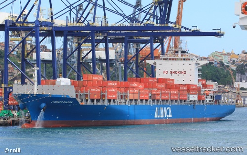
 Vicente Pinzon
Current Status
Where is the vessel?
Vicente Pinzon is currently in 19 nm NE of Lucena, based on AIS data received less than 1h ago.
Latest AIS update:
Current position: 6.69150° S, 34.62882° W (19 nm NE of Lucena)
Average speed (last 7 days): Loading…
Average speed (last 30 days): Loading…
Vessel profile: Vicente Pinzon is a Container Ship with dimensions 255m x 37m.
This page combines live AIS, route history, probable destination signals, nearby traffic, and port activity for practical vessel monitoring.
The current position of vessel Vicente Pinzon is -6.69150 lat / -34.62882 lng. Updated: 2026-05-17 07:52:27 UTCNearest reference points:
- 20 nm E of Natal
- Near Boa Viagem
- Near Suape
Currently sailing under the flag of Brazil ![]()
Details:
Live Vessel Vicente Pinzon Analytics (details, animations, etc.)
Recent AIS points (UTC):
2026-05-17 03:28:33 UTC · -5.53029, -34.94122 · SOG 16.3 kn · COG 163°2026-05-17 04:15:36 UTC · -5.73423, -34.88002 · SOG 16.1 kn · COG 158°
2026-05-17 06:28:47 UTC · -6.31831, -34.72288 · SOG 16.3 kn · COG 162°
2026-05-17 07:52:27 UTC · -6.69150, -34.62882 · SOG 16.3 kn · COG 165°