 vesseltracker.com
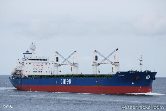
 BLUE HORIZON
Current Status
Where is the vessel?
BLUE HORIZON is currently in 89 nm E of Porto Inglez, based on AIS data received about 1h ago.
Latest AIS update:
Current position: 15.09667° N, 21.68667° W (89 nm E of Porto Inglez)
Average speed (last 7 days): Loading…
Average speed (last 30 days): Loading…
Vessel profile: BLUE HORIZON is a Bulk Carrier with dimensions m x m.
This page combines live AIS, route history, probable destination signals, nearby traffic, and port activity for practical vessel monitoring.
The current position of vessel BLUE HORIZON is 15.09667 lat / -21.68667 lng. Updated: 2026-05-15 19:38:15 UTCNearest reference points:
- Near Ilha do Sal
- 39 nm W of Ilha do Sal
Currently sailing under the flag of Liberia ![]()
Details:
Live Vessel BLUE HORIZON Analytics (details, animations, etc.)
Recent AIS points (UTC):
2026-05-15 16:11:39 UTC · 14.68139, -21.90018 · SOG 7.7 kn · COG 29°2026-05-15 17:34:21 UTC · 14.84712, -21.81170 · SOG 7.9 kn · COG 25°
2026-05-15 19:35:53 UTC · 15.09188, -21.69025 · SOG 8.1 kn · COG 24°
2026-05-15 19:38:15 UTC · 15.09667, -21.68667 · SOG 8 kn · COG -1°