 vesseltracker.com
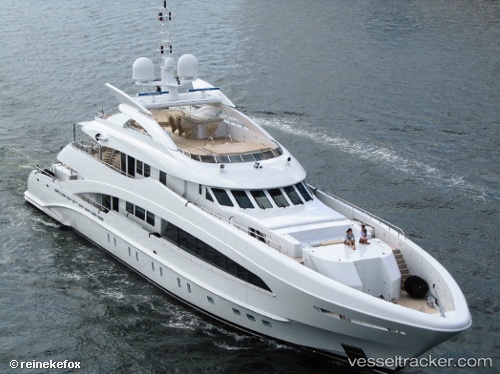
 Man Of Steel
Current Status
Where is the vessel?
Man Of Steel is currently in Near Port Everglades, based on AIS data received less than 1h ago.
Latest AIS update:
Current position: 26.09865° N, 80.16295° W (Near Port Everglades)
Average speed (last 7 days): Loading…
Average speed (last 30 days): Loading…
Vessel profile: Man Of Steel is a Service Ship with dimensions 50m x 8m.
This page combines live AIS, route history, probable destination signals, nearby traffic, and port activity for practical vessel monitoring.
The current position of vessel Man Of Steel is 26.09865 lat / -80.16295 lng. Updated: 2026-05-16 08:02:32 UTCNearest reference points:
- Near Port Everglades
- Near Fort Lauderdale
- Near Dania Beach
Currently sailing under the flag of Jamaica ![]()
Man Of Steel built in 2011 year
Deadweight:
97 tDetails:
Live Vessel Man Of Steel Analytics (details, animations, etc.)
Recent AIS points (UTC):
2026-05-16 04:11:43 UTC · 26.09863, -80.16296 · SOG 0 kn · COG 358°2026-05-16 05:50:38 UTC · 26.09867, -80.16297 · SOG 0 kn · COG 358°
2026-05-16 07:39:17 UTC · 26.09833, -80.16167 · SOG 0 kn · COG -1°
2026-05-16 08:02:32 UTC · 26.09865, -80.16295 · SOG 0 kn · COG 358°