 vesseltracker.com
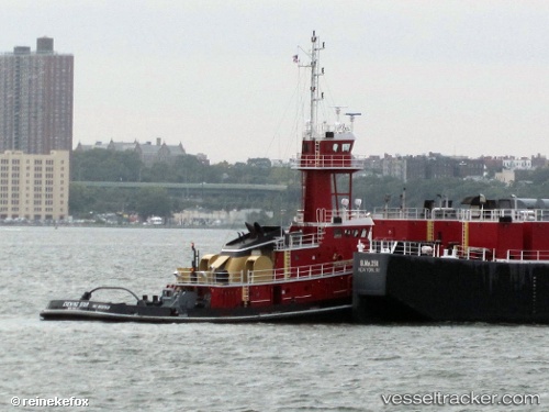
 JORDAN ROSE
Current Status
Where is the vessel?
JORDAN ROSE is currently in Near Albany, based on AIS data received about 1h ago.
Latest AIS update:
Current position: 42.61500° N, 73.75667° W (Near Albany)
Average speed (last 7 days): Loading…
Average speed (last 30 days): Loading…
Vessel profile: JORDAN ROSE is a Spare - Local Vessel with dimensions m x m.
This page combines live AIS, route history, probable destination signals, nearby traffic, and port activity for practical vessel monitoring.
The current position of vessel JORDAN ROSE is 42.61500 lat / -73.75667 lng. Updated: 2026-05-14 00:20:41 UTCNearest reference points:
- Near Purchase
- Near Southport
- Near Larchmont
Currently sailing under the flag of United States ![]()
Details:
Live Vessel JORDAN ROSE Analytics (details, animations, etc.)
Recent AIS points (UTC):
2026-05-13 19:47:14 UTC · 42.61616, -73.75773 · SOG 0 kn · COG 20°2026-05-13 21:38:43 UTC · 42.61500, -73.75667 · SOG 0 kn · COG -1°
2026-05-13 23:02:18 UTC · 42.61615, -73.75777 · SOG 0 kn · COG 21°
2026-05-14 00:20:41 UTC · 42.61500, -73.75667 · SOG 0 kn · COG -1°