 vesseltracker.com
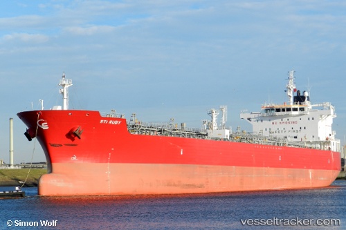
 Sti Ruby
Current Status
Where is the vessel?
Sti Ruby is currently in 11 nm W of TANJUNG PELEPAS, based on AIS data received about 1h ago.
Latest AIS update:
Current position: 1.30667° N, 103.37500° E (11 nm W of TANJUNG PELEPAS)
Average speed (last 7 days): Loading…
Average speed (last 30 days): Loading…
Vessel profile: Sti Ruby is a Chemical Oil Products Tanker with dimensions 183m x 32m.
This page combines live AIS, route history, probable destination signals, nearby traffic, and port activity for practical vessel monitoring.
The current position of vessel Sti Ruby is 1.30667 lat / 103.37500 lng. Updated: 2026-05-16 03:24:59 UTCNearest reference points:
- 15 nm W of Tanjong Bin
- 19 nm W of Tanjong Bin
- Near Tanjong Bin
Currently sailing under the flag of Marshall Is ![]()
Sti Ruby built in 2012 year
Deadweight:
49990 tDetails:
Live Vessel Sti Ruby Analytics (details, animations, etc.)
Recent AIS points (UTC):
2026-05-15 23:54:49 UTC · 1.30961, 103.37588 · SOG 0.1 kn · COG 266°2026-05-16 01:12:57 UTC · 1.30667, 103.37500 · SOG 0 kn · COG -1°
2026-05-16 02:15:56 UTC · 1.30667, 103.37500 · SOG 0 kn · COG -1°
2026-05-16 03:24:59 UTC · 1.30667, 103.37500 · SOG 0 kn · COG -1°