 vesseltracker.com
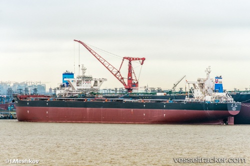
Cape Stars
Current StatusWhere is the vessel?
Cape Stars is currently in 144 nm SE of Manakara, based on AIS data received less than 1h ago.
Latest AIS update:
Current position: 23.98349° S, 49.71054° E (144 nm SE of Manakara)
Average speed (last 7 days): Loading…
Average speed (last 30 days): Loading…
Vessel profile: Cape Stars is a Bulk Carrier with dimensions 50m x 300m.
This page combines live AIS, route history, probable destination signals, nearby traffic, and port activity for practical vessel monitoring.
The current position of vessel Cape Stars is -23.98349 lat / 49.71054 lng. Updated: 2026-05-17 10:35:38 UTCNearest reference points:
- 194 nm E of Manakara
- 209 nm E of Manakara
- 271 nm E of Fort Dauphin
Details:
Live Vessel Cape Stars Analytics (details, animations, etc.)
Recent AIS points (UTC):
2026-05-17 07:48:10 UTC · -23.68130, 50.17981 · SOG 11 kn · COG 231°2026-05-17 07:57:08 UTC · -23.69753, 50.15569 · SOG 11.1 kn · COG 231°
2026-05-17 09:50:57 UTC · -23.90047, 49.83606 · SOG 11.5 kn · COG 235°
2026-05-17 10:35:38 UTC · -23.98349, 49.71054 · SOG 11.3 kn · COG 234°