 vesseltracker.com
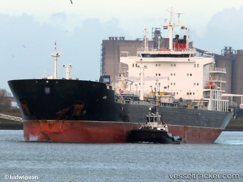
 LADY RINA
Current Status
Where is the vessel?
LADY RINA is currently in 55 nm NW of PLAYA BLANCA, based on AIS data received less than 1h ago.
Latest AIS update:
Current position: 29.37998° N, 14.69450° W (55 nm NW of PLAYA BLANCA)
Average speed (last 7 days): Loading…
Average speed (last 30 days): Loading…
Vessel profile: LADY RINA is a Chemical/Oil Products Tanker with dimensions 183m x 27m.
This page combines live AIS, route history, probable destination signals, nearby traffic, and port activity for practical vessel monitoring.
The current position of vessel LADY RINA is 29.37998 lat / -14.69450 lng. Updated: 2026-05-13 19:05:51 UTCNearest reference points:
- 56 nm NW of Caleta de Sebo
- Near LAS COLORADAS
- 58 nm N of Caleta de Sebo
Currently sailing under the flag of Italy ![]()
LADY RINA built in 2012 year
Deadweight:
39310 tDetails:
Live Vessel LADY RINA Analytics (details, animations, etc.)
Recent AIS points (UTC):
2026-05-13 15:43:50 UTC · 28.71821, -14.94130 · SOG 12.5 kn · COG 21°2026-05-13 16:21:58 UTC · 28.84574, -14.89210 · SOG 12.3 kn · COG 21°
2026-05-13 18:08:49 UTC · 29.19800, -14.76143 · SOG 11.8 kn · COG 20°
2026-05-13 19:05:51 UTC · 29.37998, -14.69450 · SOG 11.8 kn · COG 20°