 vesseltracker.com
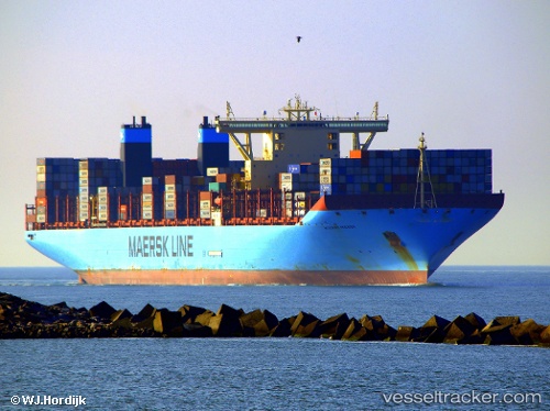
 Mogens Maersk
Current Status
Where is the vessel?
Mogens Maersk is currently in 29 nm S of Seaford, based on AIS data received about 2h ago.
Latest AIS update:
Current position: 50.31445° N, 0.14665° W (29 nm S of Seaford)
Average speed (last 7 days): Loading…
Average speed (last 30 days): Loading…
Vessel profile: Mogens Maersk is a Container Ship with dimensions 399m x 60m.
This page combines live AIS, route history, probable destination signals, nearby traffic, and port activity for practical vessel monitoring.
The current position of vessel Mogens Maersk is 50.31445 lat / -0.14665 lng. Updated: 2026-04-24 15:45:51 UTCNearest reference points:
- 27 nm S of Seaford
- 23 nm S of Ferring
- 15 nm S of Selsey
Currently sailing under the flag of Denmark ![]()
Details:
Live Vessel Mogens Maersk Analytics (details, animations, etc.)
Recent AIS points (UTC):
2026-04-24 11:38:32 UTC · 50.03060, -1.78235 · SOG 18.2 kn · COG 76°2026-04-24 13:10:07 UTC · 50.11028, -1.08072 · SOG 18.6 kn · COG 69°
2026-04-24 13:55:44 UTC · 50.19132, -0.73408 · SOG 18.7 kn · COG 68°
2026-04-24 15:45:51 UTC · 50.31445, -0.14665 · SOG 13.7 kn · COG 75°