 vesseltracker.com
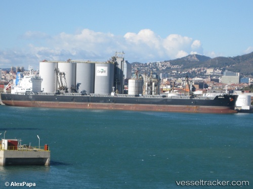
 Danhil
Current Status
Where is the vessel?
Danhil is currently in 319 nm N of Ramalde, based on AIS data received less than 1h ago.
Latest AIS update:
Current position: 36.13500° S, 10.83901° W (319 nm N of Ramalde)
Average speed (last 7 days): Loading…
Average speed (last 30 days): Loading…
Vessel profile: Danhil is a Bulk Carrier with dimensions 229m x 32m.
This page combines live AIS, route history, probable destination signals, nearby traffic, and port activity for practical vessel monitoring.
The current position of vessel Danhil is -36.13500 lat / -10.83901 lng. Updated: 2026-05-16 05:50:02 UTCNearest reference points:
- Open sea, approx. 403 nm off the nearest listed port
- Open sea, approx. 401 nm off the nearest listed port
- Open sea, approx. 404 nm off the nearest listed port
Currently sailing under the flag of Liberia ![]()
Danhil built in 2012 year
Deadweight:
81354 tDetails:
Live Vessel Danhil Analytics (details, animations, etc.)
Recent AIS points (UTC):
2026-05-16 02:26:42 UTC · -36.08500, -11.56573 · SOG 10.8 kn · COG 94°2026-05-16 03:31:51 UTC · -36.10168, -11.32648 · SOG 10.7 kn · COG 97°
2026-05-16 05:06:40 UTC · -36.12669, -10.99327 · SOG 10.4 kn · COG 93°
2026-05-16 05:50:02 UTC · -36.13500, -10.83901 · SOG 10.2 kn · COG 93°