 vesseltracker.com
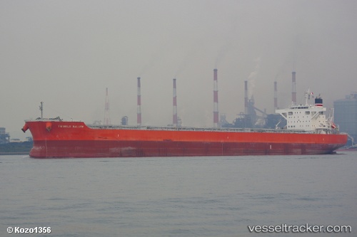
 RAGNAR
Current Status
Where is the vessel?
RAGNAR is currently in 136 nm S of Yap, based on AIS data received about 1h ago.
Latest AIS update:
Current position: 7.25681° N, 137.83002° E (136 nm S of Yap)
Average speed (last 7 days): Loading…
Average speed (last 30 days): Loading…
Vessel profile: RAGNAR is a Bulk Carrier with dimensions m x m.
This page combines live AIS, route history, probable destination signals, nearby traffic, and port activity for practical vessel monitoring.
The current position of vessel RAGNAR is 7.25681 lat / 137.83002 lng. Updated: 2026-05-14 22:17:54 UTCCurrently sailing under the flag of Marshall Islands ![]()
Details:
Live Vessel RAGNAR Analytics (details, animations, etc.)
Recent AIS points (UTC):
2026-05-14 18:54:44 UTC · 7.90043, 137.40224 · SOG 13.6 kn · COG 147°2026-05-14 18:54:44 UTC · 7.90043, 137.40224 · SOG 13.6 kn · COG 147°
2026-05-14 21:15:25 UTC · 7.46180, 137.70322 · SOG 13.8 kn · COG 147°
2026-05-14 22:17:54 UTC · 7.25681, 137.83002 · SOG 13.8 kn · COG 152°