 vesseltracker.com
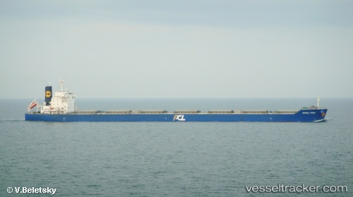
 QIAN NIU STAR
Current Status
Where is the vessel?
QIAN NIU STAR is currently in 82 nm E of Tami Island, based on AIS data received less than 1h ago.
Latest AIS update:
Current position: 6.99282° S, 149.24937° E (82 nm E of Tami Island)
Average speed (last 7 days): Loading…
Average speed (last 30 days): Loading…
Vessel profile: QIAN NIU STAR is a Bulk Carrier with dimensions m x m.
This page combines live AIS, route history, probable destination signals, nearby traffic, and port activity for practical vessel monitoring.
The current position of vessel QIAN NIU STAR is -6.99282 lat / 149.24937 lng. Updated: 2026-05-14 19:43:54 UTCNearest reference points:
- 42 nm E of Tami Island
- Near Lae
Currently sailing under the flag of Liberia ![]()
Details:
Live Vessel QIAN NIU STAR Analytics (details, animations, etc.)
Recent AIS points (UTC):
2026-05-14 16:03:53 UTC · -7.39687, 149.88783 · SOG 12.7 kn · COG 302°2026-05-14 16:52:06 UTC · -7.30316, 149.74760 · SOG 12.4 kn · COG 305°
2026-05-14 17:43:05 UTC · -7.21239, 149.59883 · SOG 12.1 kn · COG 305°
2026-05-14 19:43:54 UTC · -6.99282, 149.24937 · SOG 12.4 kn · COG 308°