 vesseltracker.com
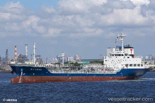
 Kirishima Maru No.17
Current Status
Where is the vessel?
Kirishima Maru No.17 is currently in Near Iwakuni, based on AIS data received less than 1h ago.
Latest AIS update:
Current position: 34.23509° N, 132.23767° E (Near Iwakuni)
Average speed (last 7 days): Loading…
Average speed (last 30 days): Loading…
Vessel profile: Kirishima Maru No.17 is a Oil Products Tanker with dimensions 91m x 14m.
This page combines live AIS, route history, probable destination signals, nearby traffic, and port activity for practical vessel monitoring.
The current position of vessel Kirishima Maru No.17 is 34.23509 lat / 132.23767 lng. Updated: 2026-05-17 13:53:48 UTCNearest reference points:
- Near Hiroshima
- Near Kure
- Near TSUWAJI
Currently sailing under the flag of Japan ![]()
Details:
Live Vessel Kirishima Maru No.17 Analytics (details, animations, etc.)
Recent AIS points (UTC):
2026-05-17 10:26:50 UTC · 34.23500, 132.23705 · SOG 0 kn · COG 8°2026-05-17 11:33:02 UTC · 34.23497, 132.23727 · SOG 0 kn · COG 359°
2026-05-17 13:50:50 UTC · 34.23510, 132.23767 · SOG 0 kn · COG 321°
2026-05-17 13:53:48 UTC · 34.23509, 132.23767 · SOG 0 kn · COG 321°