 vesseltracker.com
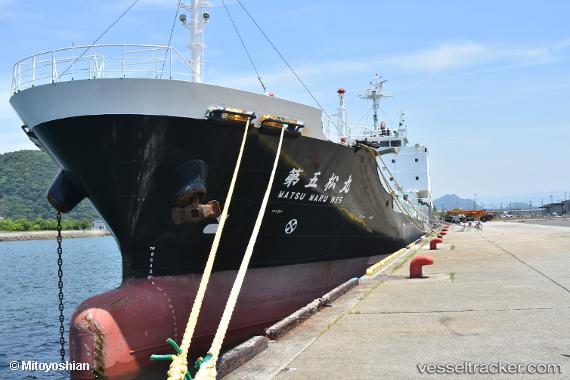
 No5 Matsumaru
Current Status
Where is the vessel?
No5 Matsumaru is currently in 12 nm E of Iruma, based on AIS data received less than 1h ago.
Latest AIS update:
Current position: 34.63257° N, 139.04927° E (12 nm E of Iruma)
Average speed (last 7 days): Loading…
Average speed (last 30 days): Loading…
Vessel profile: No5 Matsumaru is a Oil Products Tanker with dimensions 104m x 15m.
This page combines live AIS, route history, probable destination signals, nearby traffic, and port activity for practical vessel monitoring.
The current position of vessel No5 Matsumaru is 34.63257 lat / 139.04927 lng. Updated: 2026-05-14 17:39:17 UTCNearest reference points:
- Near Iruma
- 10 nm SE of Iruma
- Near Toshima/Tokyo
Currently sailing under the flag of Japan ![]()
Details:
Live Vessel No5 Matsumaru Analytics (details, animations, etc.)
Recent AIS points (UTC):
2026-05-14 14:03:50 UTC · 35.19181, 139.76105 · SOG 13.5 kn · COG 204°2026-05-14 15:48:32 UTC · 34.92208, 139.41283 · SOG 13.1 kn · COG 233°
2026-05-14 16:57:42 UTC · 34.75010, 139.18384 · SOG 13.7 kn · COG 222°
2026-05-14 17:39:17 UTC · 34.63257, 139.04927 · SOG 14.6 kn · COG 228°