 vesseltracker.com
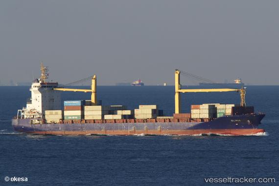
Olivia
Current StatusWhere is the vessel?
Olivia is currently in Near Choa Chu Kang, based on AIS data received less than 1h ago.
Latest AIS update:
Current position: 1.26799° N, 103.88393° E (Near Choa Chu Kang)
Average speed (last 7 days): Loading…
Average speed (last 30 days): Loading…
Vessel profile: Olivia is a Container Ship with dimensions 27m x 172m.
This page combines live AIS, route history, probable destination signals, nearby traffic, and port activity for practical vessel monitoring.
The current position of vessel Olivia is 1.26799 lat / 103.88393 lng. Updated: 2026-05-17 14:18:43 UTCNearest reference points:
- Near Choa Chu Kang
- Near Tampines
- Near Singapore
Details:
Live Vessel Olivia Analytics (details, animations, etc.)
Recent AIS points (UTC):
2026-05-17 10:03:44 UTC · 1.26896, 103.88408 · SOG 0 kn · COG 122°2026-05-17 12:00:46 UTC · 1.26729, 103.88427 · SOG 0 kn · COG 50°
2026-05-17 13:30:45 UTC · 1.26738, 103.88420 · SOG 0 kn · COG 58°
2026-05-17 14:18:43 UTC · 1.26799, 103.88393 · SOG 0.1 kn · COG 85°