 vesseltracker.com
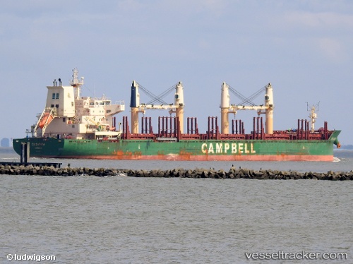
 Cs Satira
Current Status
Where is the vessel?
Cs Satira is currently in 102 nm SW of Port de Boké, based on AIS data received less than 1h ago.
Latest AIS update:
Current position: 9.16667° N, 15.75833° W (102 nm SW of Port de Boké)
Average speed (last 7 days): Loading…
Average speed (last 30 days): Loading…
Vessel profile: Cs Satira is a Bulk Carrier with dimensions 180m x 30m.
This page combines live AIS, route history, probable destination signals, nearby traffic, and port activity for practical vessel monitoring.
The current position of vessel Cs Satira is 9.16667 lat / -15.75833 lng. Updated: 2026-05-14 11:32:54 UTCNearest reference points:
- 97 nm SW of Port de Boké
- 79 nm SW of Conakry
- 49 nm S of Port de Boké
Currently sailing under the flag of Bahamas ![]()
Cs Satira built in 2013 year
Deadweight:
37650 tDetails:
Live Vessel Cs Satira Analytics (details, animations, etc.)
Recent AIS points (UTC):
2026-05-14 07:20:52 UTC · 8.59666, -15.21500 · SOG 11 kn · COG -1°2026-05-14 09:38:17 UTC · 8.90605, -15.51414 · SOG 11.2 kn · COG 320°
2026-05-14 10:37:36 UTC · 9.04194, -15.64129 · SOG 11.1 kn · COG 322°
2026-05-14 11:32:54 UTC · 9.16667, -15.75833 · SOG 11 kn · COG -1°