 vesseltracker.com
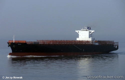
 Mary
Mary
Current Status
Where is the vessel?
Mary is currently in 18 nm SE of Galveston, based on AIS data received about 2h ago.
Latest AIS update:
Current position: 29.11791° N, 94.52211° W (18 nm SE of Galveston)
Average speed (last 7 days): Loading…
Average speed (last 30 days): Loading…
Vessel profile: Mary is a Container Ship with dimensions 270m x 43m.
This page combines live AIS, route history, probable destination signals, nearby traffic, and port activity for practical vessel monitoring.
The current position of vessel Mary is 29.11791 lat / -94.52211 lng. Updated: 2026-05-14 04:01:15 UTCNearest reference points:
- 12 nm SE of Port Bolivar
- Near Port Bolivar
- 40 nm SE of Galveston
Currently sailing under the flag of Marshall Is ![]()
Mary built in 2013 year
Deadweight:
80274 tDetails:
Live Vessel Mary Analytics (details, animations, etc.)
Recent AIS points (UTC):
2026-05-14 01:25:16 UTC · 29.11836, -94.52279 · SOG 0 kn · COG 204°2026-05-14 02:04:11 UTC · 29.11833, -94.52271 · SOG 0 kn · COG 205°
2026-05-14 03:55:14 UTC · 29.11796, -94.52213 · SOG 0 kn · COG 222°
2026-05-14 04:01:15 UTC · 29.11791, -94.52211 · SOG 0 kn · COG 223°