 vesseltracker.com
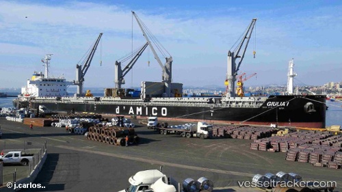
 Giulia 1
Current Status
Where is the vessel?
Giulia 1 is currently in Near Safi, based on AIS data received about 1h ago.
Latest AIS update:
Current position: 32.30906° N, 9.24662° W (Near Safi)
Average speed (last 7 days): Loading…
Average speed (last 30 days): Loading…
Vessel profile: Giulia 1 is a Bulk Carrier with dimensions 177m x 177m.
This page combines live AIS, route history, probable destination signals, nearby traffic, and port activity for practical vessel monitoring.
The current position of vessel Giulia 1 is 32.30906 lat / -9.24662 lng. Updated: 2026-05-15 19:02:50 UTCNearest reference points:
- 32 nm NW of Safi
- 52 nm NW of Safi
- Near Jorf Lasfar
Currently sailing under the flag of Malta ![]()
Details:
Live Vessel Giulia 1 Analytics (details, animations, etc.)
Recent AIS points (UTC):
2026-05-15 12:26:51 UTC · 32.30908, -9.24664 · SOG 0 kn · COG 174°2026-05-15 12:26:51 UTC · 32.30908, -9.24664 · SOG 0 kn · COG 174°
2026-05-15 19:02:50 UTC · 32.30906, -9.24662 · SOG 0 kn · COG 175°
2026-05-15 19:02:50 UTC · 32.30906, -9.24662 · SOG 0 kn · COG 175°