 vesseltracker.com
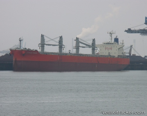
 ARMONIA
Current Status
Where is the vessel?
ARMONIA is currently in Near Takoradi, based on AIS data received less than 1h ago.
Latest AIS update:
Current position: 4.89636° N, 1.73714° W (Near Takoradi)
Average speed (last 7 days): Loading…
Average speed (last 30 days): Loading…
Vessel profile: ARMONIA is a Bulk Carrier with dimensions 197m x 197m.
This page combines live AIS, route history, probable destination signals, nearby traffic, and port activity for practical vessel monitoring.
The current position of vessel ARMONIA is 4.89636 lat / -1.73714 lng. Updated: 2026-05-14 03:23:15 UTCNearest reference points:
- Near Takoradi
- Near Sekondi
- 13 nm W of Jubilee FPSO
Currently sailing under the flag of Marshall Islands ![]()
ARMONIA built in 2013 year
Deadweight:
58609 tDetails:
Live Vessel ARMONIA Analytics (details, animations, etc.)
Recent AIS points (UTC):
2026-05-13 23:32:13 UTC · 4.89636, -1.73712 · SOG 0 kn · COG 254°2026-05-14 01:35:11 UTC · 4.89639, -1.73708 · SOG 0 kn · COG 254°
2026-05-14 01:47:10 UTC · 4.89633, -1.73715 · SOG 0 kn · COG 254°
2026-05-14 03:23:15 UTC · 4.89636, -1.73714 · SOG 0 kn · COG 254°