 vesseltracker.com
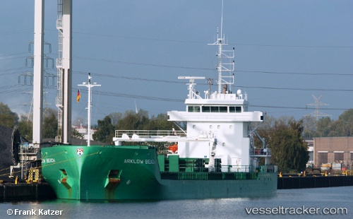
 Arklow Beach
Current Status
Where is the vessel?
Arklow Beach is currently in 24 nm SW of LES SABLES D OLONNE, based on AIS data received about 1h ago.
Latest AIS update:
Current position: 46.17396° N, 2.15748° W (24 nm SW of LES SABLES D OLONNE)
Average speed (last 7 days): Loading…
Average speed (last 30 days): Loading…
Vessel profile: Arklow Beach is a General Cargo Ship with dimensions 119m x 15m.
This page combines live AIS, route history, probable destination signals, nearby traffic, and port activity for practical vessel monitoring.
The current position of vessel Arklow Beach is 46.17396 lat / -2.15748 lng. Updated: 2026-05-14 14:05:59 UTCNearest reference points:
- 17 nm S of L'Île-d'Yeu
- Near LES SABLES D OLONNE
- Near Saint-Gilles-Croix-de-Vie
Currently sailing under the flag of Netherlands ![]()
Arklow Beach built in 2014 year
Deadweight:
8400 tDetails:
Live Vessel Arklow Beach Analytics (details, animations, etc.)
Recent AIS points (UTC):
2026-05-14 10:37:46 UTC · 45.81617, -1.62010 · SOG 9.4 kn · COG 318°2026-05-14 11:33:35 UTC · 45.92853, -1.75185 · SOG 9.3 kn · COG 318°
2026-05-14 13:37:48 UTC · 46.12817, -2.08083 · SOG 8.8 kn · COG 312°
2026-05-14 14:05:59 UTC · 46.17396, -2.15748 · SOG 9.1 kn · COG 314°