 vesseltracker.com
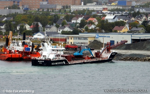
 Helene H
Current Status
Where is the vessel?
Helene H is currently in Near Harstad, based on AIS data received about 2h ago.
Latest AIS update:
Current position: 68.79165° N, 16.54634° E (Near Harstad)
Average speed (last 7 days): Loading…
Average speed (last 30 days): Loading…
Vessel profile: Helene H is a Multi Purpose Carrier with dimensions 69m x 13m.
This page combines live AIS, route history, probable destination signals, nearby traffic, and port activity for practical vessel monitoring.
The current position of vessel Helene H is 68.79165 lat / 16.54634 lng. Updated: 2026-03-26 19:18:59 UTCNearest reference points:
- Near Harstad
- Near Skrolsvik
- Near Sigerfjord
Currently sailing under the flag of Norway ![]()
Helene H built in 2013 year
Deadweight:
2396 tDetails:
Live Vessel Helene H Analytics (details, animations, etc.)
Recent AIS points (UTC):
2026-03-26 13:48:51 UTC · 68.79168, 16.54640 · SOG 0 kn · COG 4°2026-03-26 15:43:04 UTC · 68.79168, 16.54636 · SOG 0 kn · COG 6°
2026-03-26 17:25:06 UTC · 68.79167, 16.54636 · SOG 0 kn · COG 6°
2026-03-26 19:18:59 UTC · 68.79165, 16.54634 · SOG 0 kn · COG 8°