 vesseltracker.com
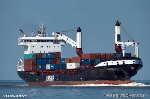
 ATLANTICO
Current Status
Where is the vessel?
ATLANTICO is currently in Near Leixoes, based on AIS data received less than 1h ago.
Latest AIS update:
Current position: 41.15593° N, 8.70756° W (Near Leixoes)
Average speed (last 7 days): Loading…
Average speed (last 30 days): Loading…
Vessel profile: ATLANTICO is a Container Ship with dimensions m x m.
This page combines live AIS, route history, probable destination signals, nearby traffic, and port activity for practical vessel monitoring.
The current position of vessel ATLANTICO is 41.15593 lat / -8.70756 lng. Updated: 2026-05-15 21:25:26 UTCNearest reference points:
- Near Matosinhos
- Near POVOA DE VARZIM
- Near Gafanha da Nazaré
Currently sailing under the flag of Portugal ![]()
Details:
Live Vessel ATLANTICO Analytics (details, animations, etc.)
Recent AIS points (UTC):
2026-05-15 17:35:30 UTC · 41.18529, -8.70067 · SOG 0 kn · COG 230°2026-05-15 19:26:32 UTC · 41.18521, -8.70072 · SOG 0 kn · COG 231°
2026-05-15 19:59:32 UTC · 41.18522, -8.70055 · SOG 0 kn · COG 231°
2026-05-15 21:25:26 UTC · 41.15593, -8.70756 · SOG 15.7 kn · COG 205°