 vesseltracker.com
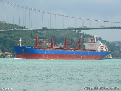
 Oceanlady
Current Status
Where is the vessel?
Oceanlady is currently in 21 nm SW of SATTAHIP, based on AIS data received about 1h ago.
Latest AIS update:
Current position: 12.35734° N, 100.68542° E (21 nm SW of SATTAHIP)
Average speed (last 7 days): Loading…
Average speed (last 30 days): Loading…
Vessel profile: Oceanlady is a Bulk Carrier with dimensions 190m x 32m.
This page combines live AIS, route history, probable destination signals, nearby traffic, and port activity for practical vessel monitoring.
The current position of vessel Oceanlady is 12.35734 lat / 100.68542 lng. Updated: 2026-04-18 06:08:15 UTCNearest reference points:
- Near SATTAHIP
- 33 nm S of SATTAHIP
- 11 nm S of Map Ta Phut
Currently sailing under the flag of Liberia ![]()
Oceanlady built in 2013 year
Deadweight:
56816 tDetails:
Live Vessel Oceanlady Analytics (details, animations, etc.)
Recent AIS points (UTC):
2026-04-17 23:32:34 UTC · 12.49192, 100.60770 · SOG 0.1 kn · COG 275°2026-04-18 02:09:24 UTC · 12.34192, 100.70676 · SOG 0.3 kn · COG 281°
2026-04-18 03:31:04 UTC · 12.33666, 100.70640 · SOG 0.1 kn · COG 264°
2026-04-18 06:08:15 UTC · 12.35734, 100.68542 · SOG 1.2 kn · COG 249°