 vesseltracker.com
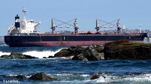
 TON HIL II
Current Status
Where is the vessel?
TON HIL II is currently in 60 nm S of Ehoala, based on AIS data received about 1h ago.
Latest AIS update:
Current position: 26.00949° S, 47.32002° E (60 nm S of Ehoala)
Average speed (last 7 days): Loading…
Average speed (last 30 days): Loading…
Vessel profile: TON HIL II is a Bulk Carrier with dimensions m x m.
This page combines live AIS, route history, probable destination signals, nearby traffic, and port activity for practical vessel monitoring.
The current position of vessel TON HIL II is -26.00949 lat / 47.32002 lng. Updated: 2026-04-27 19:41:38 UTCNearest reference points:
- 106 nm S of Tsiombe
- 174 nm S of Ambovombe
Currently sailing under the flag of Portugal ![]()
Details:
Live Vessel TON HIL II Analytics (details, animations, etc.)
Recent AIS points (UTC):
2026-04-27 16:38:45 UTC · -25.81903, 47.94249 · SOG 10.5 kn · COG 248°2026-04-27 17:47:27 UTC · -25.88133, 47.72069 · SOG 11.4 kn · COG 248°
2026-04-27 19:29:25 UTC · -25.99497, 47.36483 · SOG 12.7 kn · COG 250°
2026-04-27 19:41:38 UTC · -26.00949, 47.32002 · SOG 12.8 kn · COG 250°