 vesseltracker.com
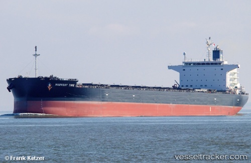
 Harvest Time
Current Status
Where is the vessel?
Harvest Time is currently in 84 nm NE of Kiska, based on AIS data received less than 1h ago.
Latest AIS update:
Current position: 53.22508° N, 178.62485° E (84 nm NE of Kiska)
Average speed (last 7 days): Loading…
Average speed (last 30 days): Loading…
Vessel profile: Harvest Time is a Bulk Carrier with dimensions 237m x 40m.
This page combines live AIS, route history, probable destination signals, nearby traffic, and port activity for practical vessel monitoring.
The current position of vessel Harvest Time is 53.22508 lat / 178.62485 lng. Updated: 2026-05-16 06:18:18 UTCNearest reference points:
- 87 nm NE of Margonin
Currently sailing under the flag of Marshall Is ![]()
Details:
Live Vessel Harvest Time Analytics (details, animations, etc.)
Recent AIS points (UTC):
2026-05-16 01:30:39 UTC · 53.06502, 177.40347 · SOG 10.2 kn · COG 74°2026-05-16 04:02:37 UTC · 53.14890, 178.06808 · SOG 9.1 kn · COG 75°
2026-05-16 05:04:31 UTC · 53.18243, 178.32217 · SOG 8.6 kn · COG 73°
2026-05-16 06:18:18 UTC · 53.22508, 178.62485 · SOG 9.7 kn · COG 71°