 vesseltracker.com
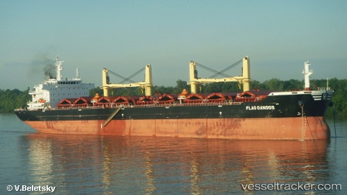
Flag Gangos
Current StatusWhere is the vessel?
Flag Gangos is currently in Near Taboneo, based on AIS data received less than 1h ago.
Latest AIS update:
Current position: 3.72667° S, 114.42167° E (Near Taboneo)
Average speed (last 7 days): Loading…
Average speed (last 30 days): Loading…
Vessel profile: Flag Gangos is a Bulk Carrier with dimensions 32m x 185m.
This page combines live AIS, route history, probable destination signals, nearby traffic, and port activity for practical vessel monitoring.
The current position of vessel Flag Gangos is -3.72667 lat / 114.42167 lng. Updated: 2026-05-16 07:46:19 UTCNearest reference points:
- Near Taboneo
- Near BANJARMASIN
- Near Bunati
Details:
Live Vessel Flag Gangos Analytics (details, animations, etc.)
Recent AIS points (UTC):
2026-05-16 04:43:52 UTC · -3.72855, 114.42220 · SOG 0 kn · COG 309°2026-05-16 06:04:17 UTC · -3.72667, 114.42167 · SOG 0 kn · COG -1°
2026-05-16 07:45:27 UTC · -3.72779, 114.42273 · SOG 0 kn · COG 287°
2026-05-16 07:46:19 UTC · -3.72667, 114.42167 · SOG 0 kn · COG -1°