 vesseltracker.com
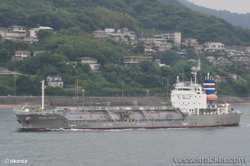
Buena Reina
Current StatusWhere is the vessel?
Buena Reina is currently in 44 nm SE of Cai Cui Port, based on AIS data received less than 1h ago.
Latest AIS update:
Current position: 9.56833° N, 107.10333° E (44 nm SE of Cai Cui Port)
Average speed (last 7 days): Loading…
Average speed (last 30 days): Loading…
Vessel profile: Buena Reina is a Lpg Tanker with dimensions 16m x 96m.
This page combines live AIS, route history, probable destination signals, nearby traffic, and port activity for practical vessel monitoring.
The current position of vessel Buena Reina is 9.56833 lat / 107.10333 lng. Updated: 2026-05-15 04:21:12 UTCNearest reference points:
- 21 nm E of Cai Cui Port
- 11 nm SE of Cape St. Jacques
- Near Cape St. Jacques
Details:
Live Vessel Buena Reina Analytics (details, animations, etc.)
Recent AIS points (UTC):
2026-05-14 22:27:11 UTC · 8.79000, 106.12500 · SOG 12 kn · COG -1°2026-05-14 23:42:09 UTC · 8.93500, 106.35333 · SOG 13 kn · COG -1°
2026-05-15 04:15:10 UTC · 9.55333, 107.08833 · SOG 12 kn · COG -1°
2026-05-15 04:21:12 UTC · 9.56833, 107.10333 · SOG 12 kn · COG -1°