 vesseltracker.com
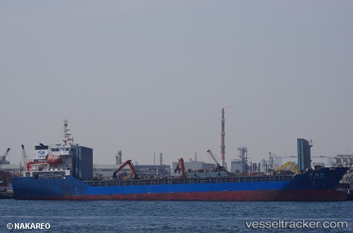
 PRINCESS SOPHIA
Current Status
Where is the vessel?
PRINCESS SOPHIA is currently in Near GEMLIK, based on AIS data received less than 1h ago.
Latest AIS update:
Current position: 40.41664° N, 29.08159° E (Near GEMLIK)
Average speed (last 7 days): Loading…
Average speed (last 30 days): Loading…
Vessel profile: PRINCESS SOPHIA is a General Cargo Ship with dimensions 108m x 18m.
This page combines live AIS, route history, probable destination signals, nearby traffic, and port activity for practical vessel monitoring.
The current position of vessel PRINCESS SOPHIA is 40.41664 lat / 29.08159 lng. Updated: 2026-05-15 04:03:40 UTCNearest reference points:
- Near GEMLIK
- 14 nm SW of Maltepe
- 11 nm S of Maltepe
Currently sailing under the flag of Barbados ![]()
PRINCESS SOPHIA built in 2012 year
Deadweight:
7541 tDetails:
Live Vessel PRINCESS SOPHIA Analytics (details, animations, etc.)
Recent AIS points (UTC):
2026-05-14 22:39:40 UTC · 40.41660, 29.08162 · SOG 0 kn · COG 124°2026-05-15 00:00:44 UTC · 40.41661, 29.08159 · SOG 0 kn · COG 123°
2026-05-15 01:00:43 UTC · 40.41664, 29.08152 · SOG 0 kn · COG 124°
2026-05-15 04:03:40 UTC · 40.41664, 29.08159 · SOG 0 kn · COG 124°