 vesseltracker.com
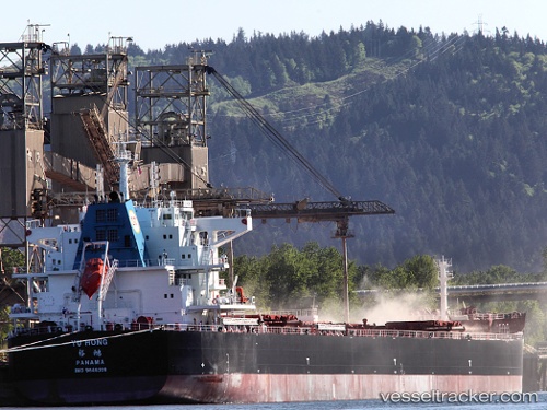
 Yu Hong
Current Status
Where is the vessel?
Yu Hong is currently in 316 nm SE of Bela Vista, based on AIS data received less than 1h ago.
Latest AIS update:
Current position: 26.77802° S, 32.25095° W (316 nm SE of Bela Vista)
Average speed (last 7 days): Loading…
Average speed (last 30 days): Loading…
Vessel profile: Yu Hong is a Bulk Carrier with dimensions 229m x 32m.
This page combines live AIS, route history, probable destination signals, nearby traffic, and port activity for practical vessel monitoring.
The current position of vessel Yu Hong is -26.77802 lat / -32.25095 lng. Updated: 2026-05-13 22:32:33 UTCCurrently sailing under the flag of Panama ![]()
Yu Hong built in 2013 year
Deadweight:
82000 tDetails:
Live Vessel Yu Hong Analytics (details, animations, etc.)
Recent AIS points (UTC):
2026-05-13 19:07:38 UTC · -26.87167, -31.63167 · SOG 9 kn · COG -1°2026-05-13 19:57:04 UTC · -26.85009, -31.77960 · SOG 9.6 kn · COG 276°
2026-05-13 21:37:33 UTC · -26.80559, -32.08133 · SOG 10.1 kn · COG 278°
2026-05-13 22:32:33 UTC · -26.77802, -32.25095 · SOG 10.2 kn · COG 279°