 vesseltracker.com
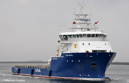
 BEN NEVIS
Current Status
Where is the vessel?
BEN NEVIS is currently in 22 nm W of Samalaju, based on AIS data received about 1h ago.
Latest AIS update:
Current position: 3.58500° N, 112.94667° E (22 nm W of Samalaju)
Average speed (last 7 days): Loading…
Average speed (last 30 days): Loading…
Vessel profile: BEN NEVIS is a Offshore Supply Ship with dimensions m x m.
This page combines live AIS, route history, probable destination signals, nearby traffic, and port activity for practical vessel monitoring.
The current position of vessel BEN NEVIS is 3.58500 lat / 112.94667 lng. Updated: 2026-05-14 11:54:50 UTCNearest reference points:
- Near BINTULU
- 19 nm E of BINTULU
- 42 nm W of BINTULU
Currently sailing under the flag of Panama ![]()
Details:
Live Vessel BEN NEVIS Analytics (details, animations, etc.)
Recent AIS points (UTC):
2026-05-14 07:48:45 UTC · 3.58500, 112.94667 · SOG 0 kn · COG -1°2026-05-14 09:21:44 UTC · 3.58500, 112.94667 · SOG 0 kn · COG -1°
2026-05-14 10:21:45 UTC · 3.58500, 112.94667 · SOG 0 kn · COG -1°
2026-05-14 11:54:50 UTC · 3.58500, 112.94667 · SOG 0 kn · COG -1°