 vesseltracker.com
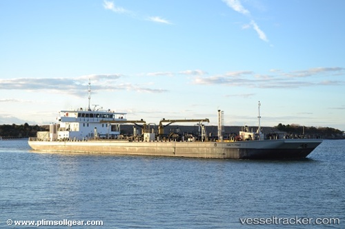
 Hunts Point
Current Status
Where is the vessel?
Hunts Point is currently in Near Maher Terminal, based on AIS data received about 1d ago.
Latest AIS update:
Current position: 40.64418° N, 74.11356° W (Near Maher Terminal)
Average speed (last 7 days): Loading…
Average speed (last 30 days): Loading…
Vessel profile: Hunts Point is a Waste Disposal Vessel with dimensions 88m x 21m.
This page combines live AIS, route history, probable destination signals, nearby traffic, and port activity for practical vessel monitoring.
The current position of vessel Hunts Point is 40.64418 lat / -74.11356 lng. Updated: 2026-05-13 13:03:04 UTCNearest reference points:
- Near Maher Terminal
- Near Port Ivory/Staten Isl/New York
- Near Tompkinsville
Currently sailing under the flag of USA ![]()
Details:
Live Vessel Hunts Point Analytics (details, animations, etc.)
Recent AIS points (UTC):
2026-05-13 13:03:04 UTC · 40.64418, -74.11356 · SOG 0 kn · COG 53°2026-05-13 13:03:04 UTC · 40.64418, -74.11356 · SOG 0 kn · COG 53°
2026-05-13 13:03:04 UTC · 40.64418, -74.11356 · SOG 0 kn · COG 53°
2026-05-13 13:03:04 UTC · 40.64418, -74.11356 · SOG 0 kn · COG 53°