 vesseltracker.com
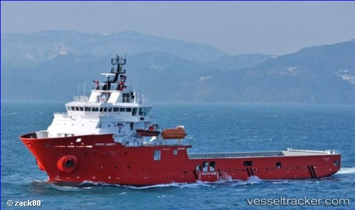
 PACIFIC LIBERTY
Current Status
Where is the vessel?
PACIFIC LIBERTY is currently in Near LABUAN, based on AIS data received about 1h ago.
Latest AIS update:
Current position: 5.26047° N, 115.26161° E (Near LABUAN)
Average speed (last 7 days): Loading…
Average speed (last 30 days): Loading…
Vessel profile: PACIFIC LIBERTY is a Other Type with dimensions m x m.
This page combines live AIS, route history, probable destination signals, nearby traffic, and port activity for practical vessel monitoring.
The current position of vessel PACIFIC LIBERTY is 5.26047 lat / 115.26161 lng. Updated: 2026-05-14 10:42:27 UTCNearest reference points:
- 44 nm SW of Tembungo
- Near Kikeh
- Near Kota Kinabalu
Currently sailing under the flag of United Kingdom ![]()
Details:
Live Vessel PACIFIC LIBERTY Analytics (details, animations, etc.)
Recent AIS points (UTC):
2026-05-14 07:45:28 UTC · 5.26062, 115.26135 · SOG 0 kn · COG 216°2026-05-14 07:54:27 UTC · 5.26063, 115.26139 · SOG 0.1 kn · COG 219°
2026-05-14 09:21:28 UTC · 5.26039, 115.26171 · SOG 0 kn · COG 264°
2026-05-14 10:42:27 UTC · 5.26047, 115.26161 · SOG 0 kn · COG 263°