 vesseltracker.com
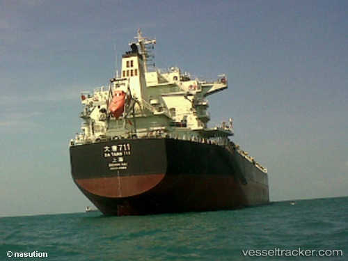
 Datang712
Current Status
Where is the vessel?
Datang712 is currently in 14 nm S of Chaoyang Pt, based on AIS data received less than 1h ago.
Latest AIS update:
Current position: 23.03991° N, 116.62616° E (14 nm S of Chaoyang Pt)
Average speed (last 7 days): Loading…
Average speed (last 30 days): Loading…
Vessel profile: Datang712 is a Bulk Carrier with dimensions 225m x 225m.
This page combines live AIS, route history, probable destination signals, nearby traffic, and port activity for practical vessel monitoring.
The current position of vessel Datang712 is 23.03991 lat / 116.62616 lng. Updated: 2026-05-15 08:21:25 UTCNearest reference points:
- 12 nm E of Jinghai
- Near Chaoyang Pt
- 14 nm S of Guang'ao
Currently sailing under the flag of China ![]()
Details:
Live Vessel Datang712 Analytics (details, animations, etc.)
Recent AIS points (UTC):
2026-05-15 04:30:21 UTC · 23.04064, 116.62610 · SOG 0 kn · COG 74°2026-05-15 06:12:16 UTC · 23.03956, 116.62674 · SOG 0.1 kn · COG 50°
2026-05-15 08:00:20 UTC · 23.03982, 116.62630 · SOG 0.1 kn · COG 58°
2026-05-15 08:21:25 UTC · 23.03991, 116.62616 · SOG 0 kn · COG 60°