 vesseltracker.com
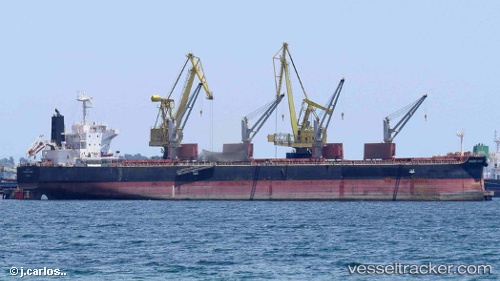
 ALTUS
ALTUS
Current Status
Where is the vessel?
ALTUS is currently in 147 nm NW of Aquiraz, based on AIS data received less than 1h ago.
Latest AIS update:
Current position: 1.90167° S, 29.79500° W (147 nm NW of Aquiraz)
Average speed (last 7 days): Loading…
Average speed (last 30 days): Loading…
Vessel profile: ALTUS is a Bulk Carrier with dimensions 100m x 101m.
This page combines live AIS, route history, probable destination signals, nearby traffic, and port activity for practical vessel monitoring.
The current position of vessel ALTUS is -1.90167 lat / -29.79500 lng. Updated: 2026-05-15 07:52:50 UTCCurrently sailing under the flag of Cyprus ![]()
ALTUS built in 2012 year
Deadweight:
58630 tDetails:
Live Vessel ALTUS Analytics (details, animations, etc.)
Recent AIS points (UTC):
2026-05-15 04:54:58 UTC · -2.37763, -30.03503 · SOG 10.6 kn · COG 30°2026-05-15 05:49:47 UTC · -2.23724, -29.95822 · SOG 10.5 kn · COG 29°
2026-05-15 07:30:05 UTC · -1.96459, -29.82688 · SOG 10.6 kn · COG 28°
2026-05-15 07:52:50 UTC · -1.90167, -29.79500 · SOG 11 kn · COG -1°