 vesseltracker.com
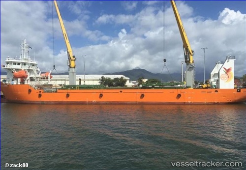
Fly Alliance
Current StatusWhere is the vessel?
Fly Alliance is currently in Near Aiambak, based on AIS data received about 1h ago.
Latest AIS update:
Current position: 7.49333° S, 141.27667° E (Near Aiambak)
Average speed (last 7 days): Loading…
Average speed (last 30 days): Loading…
Vessel profile: Fly Alliance is a Container Ship with dimensions 19m x 91m.
This page combines live AIS, route history, probable destination signals, nearby traffic, and port activity for practical vessel monitoring.
The current position of vessel Fly Alliance is -7.49333 lat / 141.27667 lng. Updated: 2026-04-27 23:47:25 UTCNearest reference points:
- Near Manda
- 53 nm N of Manda
- 34 nm NW of MERAUKE
Details:
Live Vessel Fly Alliance Analytics (details, animations, etc.)
Recent AIS points (UTC):
2026-04-27 20:18:16 UTC · -7.59746, 141.41515 · SOG 6.3 kn · COG 284°2026-04-27 21:56:30 UTC · -7.56107, 141.30199 · SOG 2 kn · COG 43°
2026-04-27 22:44:23 UTC · -7.50833, 141.31168 · SOG 7 kn · COG -1°
2026-04-27 23:47:25 UTC · -7.49333, 141.27667 · SOG 7 kn · COG -1°