 vesseltracker.com
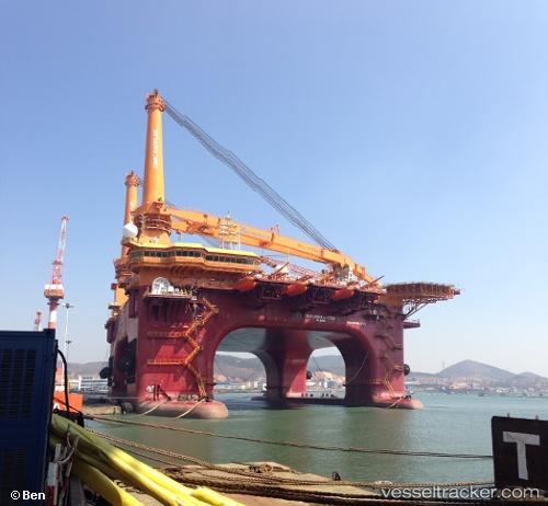
 BLUE GRETHA
Current Status
Where is the vessel?
BLUE GRETHA is currently in Near Moorreesburg, based on AIS data received about 1h ago.
Latest AIS update:
Current position: 34.58401° S, 18.69456° E (Near Moorreesburg)
Average speed (last 7 days): Loading…
Average speed (last 30 days): Loading…
Vessel profile: BLUE GRETHA is a Maintenance Platform with dimensions m x m.
This page combines live AIS, route history, probable destination signals, nearby traffic, and port activity for practical vessel monitoring.
The current position of vessel BLUE GRETHA is -34.58401 lat / 18.69456 lng. Updated: 2026-05-14 20:04:13 UTCNearest reference points:
- 15 nm SE of Moorreesburg
- Near Mitchells Plain
- 18 nm SW of Cape Of Good Hope
Currently sailing under the flag of Marshall Islands ![]()
Details:
Live Vessel BLUE GRETHA Analytics (details, animations, etc.)
Recent AIS points (UTC):
2026-05-14 16:20:22 UTC · -34.73846, 19.11831 · SOG 6 kn · COG 297°2026-05-14 17:21:42 UTC · -34.68896, 19.00537 · SOG 6 kn · COG 295°
2026-05-14 19:42:13 UTC · -34.60155, 18.73942 · SOG 6.5 kn · COG 294°
2026-05-14 20:04:13 UTC · -34.58401, 18.69456 · SOG 7.1 kn · COG 292°