 vesseltracker.com
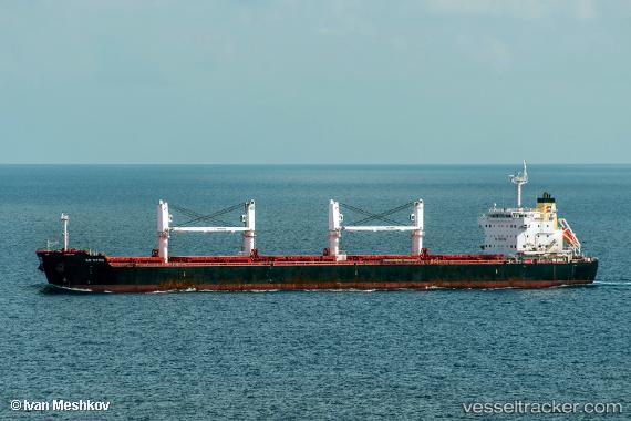
 EVEREST
Current Status
Where is the vessel?
EVEREST is currently in Near Kakinada, based on AIS data received about 1h ago.
Latest AIS update:
Current position: 16.99342° N, 82.31634° E (Near Kakinada)
Average speed (last 7 days): Loading…
Average speed (last 30 days): Loading…
Vessel profile: EVEREST is a Bulk Carrier with dimensions m x m.
This page combines live AIS, route history, probable destination signals, nearby traffic, and port activity for practical vessel monitoring.
The current position of vessel EVEREST is 16.99342 lat / 82.31634 lng. Updated: 2026-05-14 02:19:39 UTCNearest reference points:
- Near Vishakhapatnam
- Near Wipro Sez/Resapuvanipalem
Currently sailing under the flag of Barbados ![]()
Details:
Live Vessel EVEREST Analytics (details, animations, etc.)
Recent AIS points (UTC):
2026-05-13 22:49:38 UTC · 16.99364, 82.31597 · SOG 0 kn · COG 39°2026-05-13 23:19:39 UTC · 16.99370, 82.31590 · SOG 0 kn · COG 41°
2026-05-14 01:01:37 UTC · 16.99357, 82.31605 · SOG 0 kn · COG 31°
2026-05-14 02:19:39 UTC · 16.99342, 82.31634 · SOG 0.1 kn · COG 20°