 vesseltracker.com
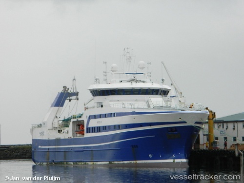
 Langoey
Current Status
Where is the vessel?
Langoey is currently in 87 nm SE of Hopen, based on AIS data received less than 1h ago.
Latest AIS update:
Current position: 75.33079° N, 28.14655° E (87 nm SE of Hopen)
Average speed (last 7 days): Loading…
Average speed (last 30 days): Loading…
Vessel profile: Langoey is a Fishing Vessel with dimensions 75m x 16m.
This page combines live AIS, route history, probable destination signals, nearby traffic, and port activity for practical vessel monitoring.
The current position of vessel Langoey is 75.33079 lat / 28.14655 lng. Updated: 2026-05-15 13:37:54 UTCCurrently sailing under the flag of Norway ![]()
Langoey built in 2013 year
Deadweight:
1500 tDetails:
Live Vessel Langoey Analytics (details, animations, etc.)
Recent AIS points (UTC):
2026-05-15 09:11:07 UTC · 75.03500, 24.86667 · SOG 11 kn · COG -1°2026-05-15 10:17:08 UTC · 75.11500, 25.65667 · SOG 11 kn · COG -1°
2026-05-15 11:38:15 UTC · 75.21035, 26.64904 · SOG 12 kn · COG 74°
2026-05-15 13:37:54 UTC · 75.33079, 28.14655 · SOG 11.8 kn · COG 82°