 vesseltracker.com
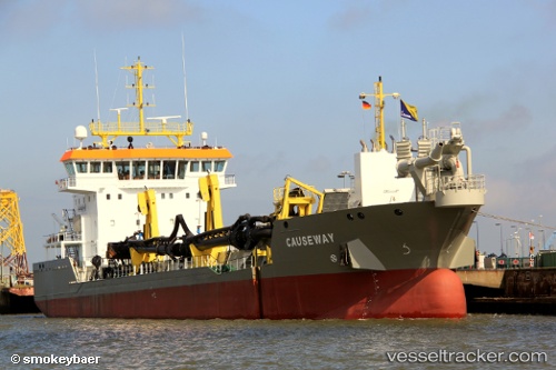
Causeway
Current StatusWhere is the vessel?
Causeway is currently in Near Aného, based on AIS data received less than 1h ago.
Latest AIS update:
Current position: 6.22667° N, 1.61333° E (Near Aného)
Average speed (last 7 days): Loading…
Average speed (last 30 days): Loading…
Vessel profile: Causeway is a Hopper Dredger with dimensions 19m x 91m.
This page combines live AIS, route history, probable destination signals, nearby traffic, and port activity for practical vessel monitoring.
The current position of vessel Causeway is 6.22667 lat / 1.61333 lng. Updated: 2026-05-17 23:23:04 UTCNearest reference points:
- Near Ablogamé
- Near Cotonou
- Near Kirikiri
Details:
Live Vessel Causeway Analytics (details, animations, etc.)
Recent AIS points (UTC):
2026-05-17 20:08:03 UTC · 6.18167, 1.56833 · SOG 8 kn · COG -1°2026-05-17 21:44:13 UTC · 6.12131, 1.49935 · SOG 1.5 kn · COG 48°
2026-05-17 22:44:03 UTC · 6.20333, 1.59167 · SOG 8 kn · COG -1°
2026-05-17 23:23:04 UTC · 6.22667, 1.61333 · SOG 1 kn · COG -1°