 vesseltracker.com
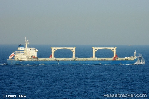
 YIN HE
Current Status
Where is the vessel?
YIN HE is currently in 10 nm W of Madura Terminal, based on AIS data received about 1h ago.
Latest AIS update:
Current position: 6.82228° S, 112.78079° E (10 nm W of Madura Terminal)
Average speed (last 7 days): Loading…
Average speed (last 30 days): Loading…
Vessel profile: YIN HE is a Cargo with dimensions m x m.
This page combines live AIS, route history, probable destination signals, nearby traffic, and port activity for practical vessel monitoring.
The current position of vessel YIN HE is -6.82228 lat / 112.78079 lng. Updated: 2026-05-14 20:15:19 UTCNearest reference points:
- 11 nm W of Madura Terminal
- Near Bangkalan
- 10 nm W of Poleng
Currently sailing under the flag of China ![]()
Details:
Live Vessel YIN HE Analytics (details, animations, etc.)
Recent AIS points (UTC):
2026-05-14 17:00:14 UTC · -6.82480, 112.78418 · SOG 2.2 kn · COG 310°2026-05-14 18:15:19 UTC · -6.82125, 112.78212 · SOG 0.2 kn · COG 180°
2026-05-14 19:15:17 UTC · -6.82242, 112.78080 · SOG 0.1 kn · COG 109°
2026-05-14 20:15:19 UTC · -6.82228, 112.78079 · SOG 0.1 kn · COG 116°