 vesseltracker.com
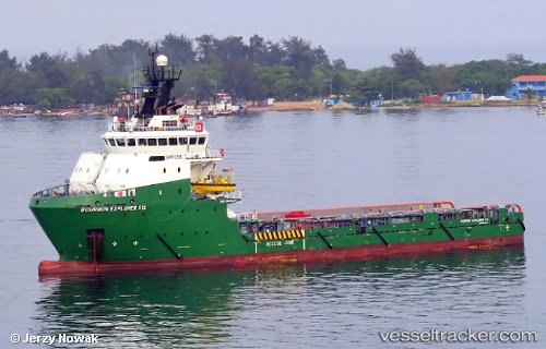
Bourbon Explorer 512
Current StatusWhere is the vessel?
Bourbon Explorer 512 is currently in Near Armada Olombendo FPSO, based on AIS data received less than 1h ago.
Latest AIS update:
Current position: 6.16300° S, 11.24048° E (Near Armada Olombendo FPSO)
Average speed (last 7 days): Loading…
Average speed (last 30 days): Loading…
Vessel profile: Bourbon Explorer 512 is a Offshore Tug Supply Ship with dimensions 17m x 78m.
This page combines live AIS, route history, probable destination signals, nearby traffic, and port activity for practical vessel monitoring.
The current position of vessel Bourbon Explorer 512 is -6.16300 lat / 11.24048 lng. Updated: 2026-05-15 01:10:42 UTCNearest reference points:
- Near N'Kossa Terminal
- 11 nm W of Cabinda
- Near SOYO
Details:
Live Vessel Bourbon Explorer 512 Analytics (details, animations, etc.)
Recent AIS points (UTC):
2026-05-14 21:56:53 UTC · -6.16384, 11.25016 · SOG 0.2 kn · COG 185°2026-05-14 22:34:43 UTC · -6.16368, 11.24817 · SOG 0.4 kn · COG 184°
2026-05-14 23:56:43 UTC · -6.16167, 11.24333 · SOG 0 kn · COG -1°
2026-05-15 01:10:42 UTC · -6.16300, 11.24048 · SOG 0.3 kn · COG 185°