 vesseltracker.com
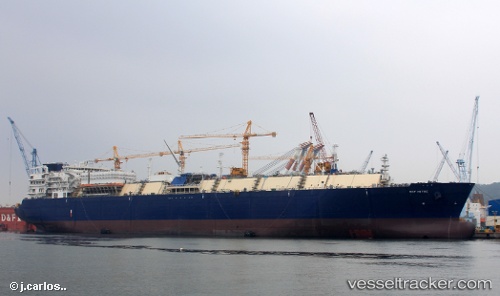
 KOOL BOREAS
Current Status
Where is the vessel?
KOOL BOREAS is currently in 196 nm S of Eauripik Atoll, based on AIS data received less than 1h ago.
Latest AIS update:
Current position: 3.49923° N, 142.44530° E (196 nm S of Eauripik Atoll)
Average speed (last 7 days): Loading…
Average speed (last 30 days): Loading…
Vessel profile: KOOL BOREAS is a LNG Tanker with dimensions 46m x 300m.
This page combines live AIS, route history, probable destination signals, nearby traffic, and port activity for practical vessel monitoring.
The current position of vessel KOOL BOREAS is 3.49923 lat / 142.44530 lng. Updated: 2026-05-14 07:44:36 UTCCurrently sailing under the flag of Liberia ![]()
KOOL BOREAS built in 2015 year
Deadweight:
93585 tDetails:
Live Vessel KOOL BOREAS Analytics (details, animations, etc.)
Recent AIS points (UTC):
2026-05-14 04:22:57 UTC · 4.25878, 141.99886 · SOG 15.5 kn · COG 156°2026-05-14 06:13:04 UTC · 3.84833, 142.24834 · SOG 16 kn · COG -1°
2026-05-14 07:34:05 UTC · 3.53833, 142.42332 · SOG 16 kn · COG -1°
2026-05-14 07:44:36 UTC · 3.49923, 142.44530 · SOG 15.7 kn · COG 150°