 vesseltracker.com
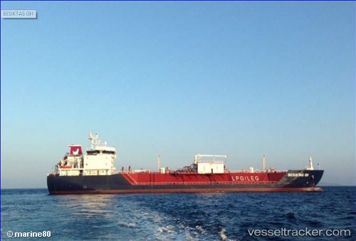
 BESIKTAS GH
Current Status
Where is the vessel?
BESIKTAS GH is currently in Near SANTA CLARA, based on AIS data received about 1h ago.
Latest AIS update:
Current position: 29.94632° S, 51.31279° W (Near SANTA CLARA)
Average speed (last 7 days): Loading…
Average speed (last 30 days): Loading…
Vessel profile: BESIKTAS GH is a LPG Tanker with dimensions 19m x 123m.
This page combines live AIS, route history, probable destination signals, nearby traffic, and port activity for practical vessel monitoring.
The current position of vessel BESIKTAS GH is -29.94632 lat / -51.31279 lng. Updated: 2026-05-14 13:41:24 UTCNearest reference points:
- Near Rio Grande
- 24 nm SE of São José do Norte
Currently sailing under the flag of Marshall Islands ![]()
BESIKTAS GH built in 2013 year
Deadweight:
9212 tDetails:
Live Vessel BESIKTAS GH Analytics (details, animations, etc.)
Recent AIS points (UTC):
2026-05-14 11:14:21 UTC · -29.90175, -51.37351 · SOG 0 kn · COG 134°2026-05-14 11:50:20 UTC · -29.90179, -51.37348 · SOG 0 kn · COG 134°
2026-05-14 13:29:34 UTC · -29.94049, -51.32115 · SOG 5.3 kn · COG 134°
2026-05-14 13:41:24 UTC · -29.94632, -51.31279 · SOG 1.3 kn · COG 111°