 vesseltracker.com
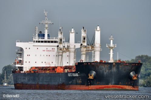
 PUERTO ROSARIO
Current Status
Where is the vessel?
PUERTO ROSARIO is currently in Near Kandla, based on AIS data received about 1h ago.
Latest AIS update:
Current position: 22.99899° N, 70.22414° E (Near Kandla)
Average speed (last 7 days): Loading…
Average speed (last 30 days): Loading…
Vessel profile: PUERTO ROSARIO is a Bulk Carrier with dimensions 32m x 200m.
This page combines live AIS, route history, probable destination signals, nearby traffic, and port activity for practical vessel monitoring.
The current position of vessel PUERTO ROSARIO is 22.99899 lat / 70.22414 lng. Updated: 2026-05-12 22:08:07 UTCNearest reference points:
- Near Kandla
- Near Kandla-SEZ/Gandhidham
- 15 nm N of Rozi
Currently sailing under the flag of Panama ![]()
PUERTO ROSARIO built in 2014 year
Deadweight:
64689 tDetails:
Live Vessel PUERTO ROSARIO Analytics (details, animations, etc.)
Recent AIS points (UTC):
2026-05-12 19:47:07 UTC · 22.99901, 70.22417 · SOG 0 kn · COG 177°2026-05-12 20:20:07 UTC · 22.99893, 70.22415 · SOG 0 kn · COG 177°
2026-05-12 21:35:07 UTC · 22.99897, 70.22417 · SOG 0 kn · COG 177°
2026-05-12 22:08:07 UTC · 22.99899, 70.22414 · SOG 0 kn · COG 177°