 vesseltracker.com
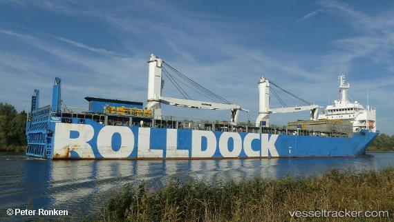
 Rolldock Storm
Current Status
Where is the vessel?
Rolldock Storm is currently in 28 nm NW of Leba, based on AIS data received about 1h ago.
Latest AIS update:
Current position: 55.05010° N, 16.94266° E (28 nm NW of Leba)
Average speed (last 7 days): Loading…
Average speed (last 30 days): Loading…
Vessel profile: Rolldock Storm is a Heavy Load Carrier with dimensions 151m x 151m.
This page combines live AIS, route history, probable destination signals, nearby traffic, and port activity for practical vessel monitoring.
The current position of vessel Rolldock Storm is 55.05010 lat / 16.94266 lng. Updated: 2026-05-16 14:07:26 UTCNearest reference points:
- 31 nm NW of Ustka
- Near WLADYSLAWOWO
- Near KOLOBRZEG
Currently sailing under the flag of Netherlands ![]()
Rolldock Storm built in 2014 year
Deadweight:
9000 tDetails:
Live Vessel Rolldock Storm Analytics (details, animations, etc.)
Recent AIS points (UTC):
2026-05-16 10:03:05 UTC · 55.05007, 16.94343 · SOG 0.1 kn · COG 349°2026-05-16 12:23:05 UTC · 55.05009, 16.94276 · SOG 0.1 kn · COG 14°
2026-05-16 14:00:35 UTC · 55.05009, 16.94266 · SOG 0 kn · COG 5°
2026-05-16 14:07:26 UTC · 55.05010, 16.94266 · SOG 0 kn · COG 6°