 vesseltracker.com
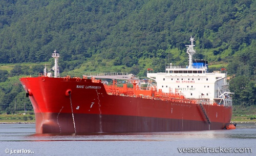
 NAVE LUMINOSITY
Current Status
Where is the vessel?
NAVE LUMINOSITY is currently in 177 nm E of Raichur, based on AIS data received less than 1h ago.
Latest AIS update:
Current position: 15.14671° N, 74.50433° W (177 nm E of Raichur)
Average speed (last 7 days): Loading…
Average speed (last 30 days): Loading…
Vessel profile: NAVE LUMINOSITY is a Tanker with dimensions m x m.
This page combines live AIS, route history, probable destination signals, nearby traffic, and port activity for practical vessel monitoring.
The current position of vessel NAVE LUMINOSITY is 15.14671 lat / -74.50433 lng. Updated: 2026-05-14 04:08:01 UTCCurrently sailing under the flag of Panama ![]()
Details:
Live Vessel NAVE LUMINOSITY Analytics (details, animations, etc.)
Recent AIS points (UTC):
2026-05-14 01:41:32 UTC · 14.99720, -73.98615 · SOG 13 kn · COG 277°2026-05-14 01:52:42 UTC · 15.00882, -74.02566 · SOG 12.8 kn · COG 279°
2026-05-14 04:08:01 UTC · 15.14671, -74.50433 · SOG 13 kn · COG 284°
2026-05-14 04:08:01 UTC · 15.14671, -74.50433 · SOG 13 kn · COG 284°