 vesseltracker.com
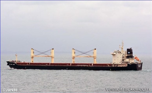
 BATMAN
Current Status
Where is the vessel?
BATMAN is currently in Near Vila do Conde Pt/Barcarena, based on AIS data received about 1h ago.
Latest AIS update:
Current position: 1.53561° S, 48.78058° W (Near Vila do Conde Pt/Barcarena)
Average speed (last 7 days): Loading…
Average speed (last 30 days): Loading…
Vessel profile: BATMAN is a Cargo with dimensions m x m.
This page combines live AIS, route history, probable destination signals, nearby traffic, and port activity for practical vessel monitoring.
The current position of vessel BATMAN is -1.53561 lat / -48.78058 lng. Updated: 2026-04-28 20:06:35 UTCNearest reference points:
- Near Belem
- Near Santana
- 55 nm N of Tucuma
Currently sailing under the flag of Marshall Islands ![]()
Details:
Live Vessel BATMAN Analytics (details, animations, etc.)
Recent AIS points (UTC):
2026-04-28 16:24:35 UTC · -1.53690, -48.78075 · SOG 0 kn · COG 270°2026-04-28 17:03:33 UTC · -1.53657, -48.78074 · SOG 0 kn · COG 260°
2026-04-28 17:36:35 UTC · -1.53652, -48.78067 · SOG 0 kn · COG 258°
2026-04-28 20:06:35 UTC · -1.53561, -48.78058 · SOG 0 kn · COG 238°